Another opportunity to take the van back on the road as we are traveling to Canberra to visit our family, so we decide to visit a number of Victoria and NSW rural towns that prior to modern freeways you had no option but to travel through.
First stop for a cuppa in Shepparton. Lovely winter sun 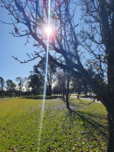
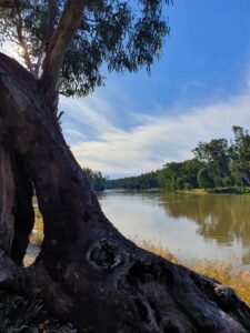 Arrive in Cobram situated on Australia’s longest river, The Murray, at 2500klm, rising in the Great Divide on the east coast, flowing west entering the ocean south of Adelaide. It’s tributaries include five of the next six longest rivers of Australia
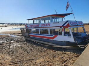
Cobram sits on the southern side of the Murray that separates the border between Victoria and NSW. A popular spot for river cruises, water skiing, golf, and much more.
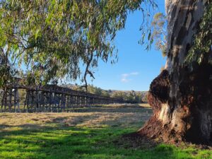
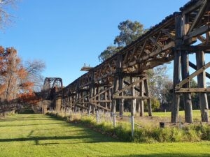
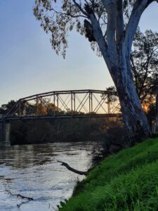
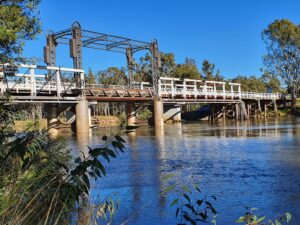 The old rail bridge with a central lift mechanism, built in 1902, to enable paddle steamers to pass. Part of the vital infrastructure that opened up inland Australia.
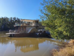
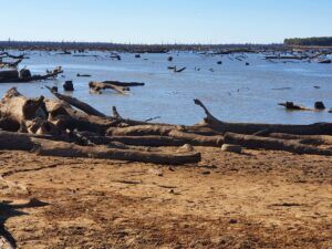
Downstream from Cobram is Yarrawonga, situated on Lake Mulwala, a man–made reservoir constructed in 1939 to provide water for irrigation for the surrounding district. It is also a popular water sport destination for holiday makers, but due to an invasive weed (Egeria Densa) over the last few decades, it is essential to lower the level ever 5 years or so, to control the weed that makes water activities limited. This exposes many of the old stumps that were logged to create the lake. This happens in the winter months between May-July as the colder weather causes the weed to wilt and die. It will be back to normal levels in August.
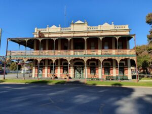 Over the river into Tocumwal. A lovely colonial hotel.
Next Stop Gundagai, this town is situated on the Murrumbidgee River which flows into the Murray.
It has a rich cultural heritage, a picturesque country town in the beautiful Riverina. You’ll find the famous Dog on the Tuckerbox Pioneer Monument, as well as a rich architectural, colonial and indigenous history, great fishing, a thrilling rodeo and boutique wineries.
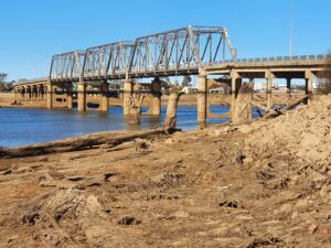
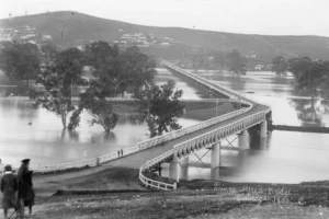
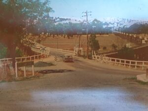
The town is famous for it’s iron truss and timber structure road bridge built in the 1860’s (Prince Alfred) and a rail bridge in 1902. It was the main road bridge linking Melbourne and Sydney, until the new freeway bridge built in 1977 bypassed the town. It was closed in 1984. Both are around 900 mtrs in length.
In 1852 78 lives were lost when the town was under 5mtr of water.
The area was prone to flooding until better regulation of flows upstream were put in place. The movements of the wooden planks whilst traversing the bridge was particularly dangerous for motor bike riders. I have great memories of crossing it.
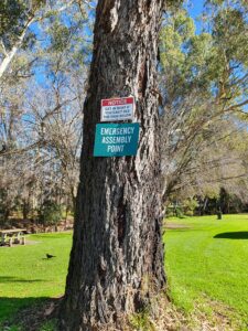
Our camp right beside the river. A sign on the tree says “Get in boat if you can’t see the sign below” Me thinks that might be too late.
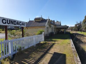
The Gundagai railway line and station date from 1886. It was an important passenger, mail & freight between Melbourne and Sydney for 100 years, however serious flooding damaged the bridge, line and infrastructure in 1984, so the branch line was closed. An old photo where the rail and road bridge across the flood plain meet on the Gundagai side.
Arrive in Canberra, to be met by Chanelle and Lina her pet terrier.
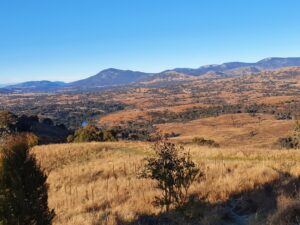
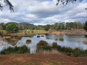
Classic Canberra weather from the top of Sean & Rosemarie’s closest hill at 800mtrs. It is a 20min walk to the top. In the foreground is the Murrumbidgee River surrounded by the Brindabella Ranges with peaks rising to 1900mtr. Canberra itself is situated at over 600mtr, so winter days are cold and clear with temperatures ranging from below freezing in the morning to 12-14 deg during the day, bathed in wonderful sunshine. Summer average temps are in the high 20’s and very dry, with winter, snow is rare as rainfall averages about 40mm a month.
Canberra is a planned city, prior to European settlement, it was inhabited by Indigenous Australians for up to 21,000 years, by the Ngunnawal people. Following a long dispute over whether Sydney or Melbourne should be the national capital, a compromise was reached: the new capital would be built in New South Wales, so long as it was at least 100 miles (160 km) from Sydney. The capital city was founded and formally named as Canberra in 1913. A blueprint by American architects Walter Burley Griffin and Marion Mahony Griffin was selected after an international design contest, and construction commenced in 1913.
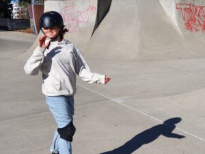
Tiarni testing her skills at the skate park. A wonderful feature of Canberra (pop 450k), is its garden city approach with extensive park lands, natural vegetation incorporated in any developments, all inter-connected by pathways under roads, sporting facilities, lakes, waterways etc.
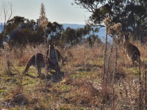
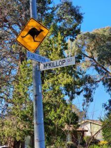
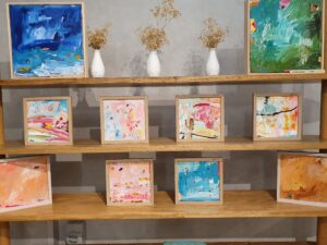
Rosemarie’s Art Exhibition and not your usual city street sign alerting you to kangaroos. Yes, they are often on the streets and in local gardens.
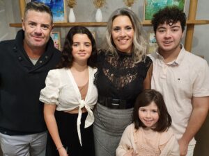 The family, Sean, Tiarni, Rosemarie, Chanelle & Aden
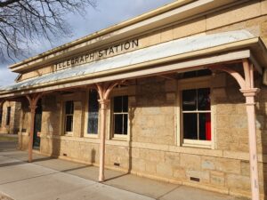
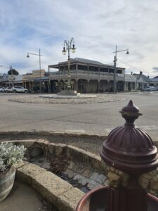
After a wonderful few days, time to head south back to Melbourne via a stop in Beechworth in Northern Victoria. Beechworth is a well-preserved historical town located in the north-east of Victoria, Australia, famous for its major growth during the gold rush days of the mid-1850s. Beechworth has a population of over 4000.
Robert Burke leader of the ill-fated Burke and Wills Expedition was stationed in Beechworth as Senior Inspector of Police from 1854 to 1857.
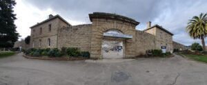
Ned Kelly, Australia’s famous bushranger and outlaw, was imprisoned in Beechworth.
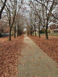
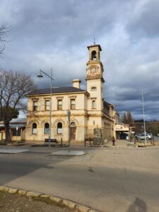
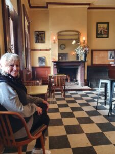
We are camped by the lake, a short walk through the parks into town, winter is here. Some historical buildings and the jail that housed Ned. Finally a drink beside a warm fire